
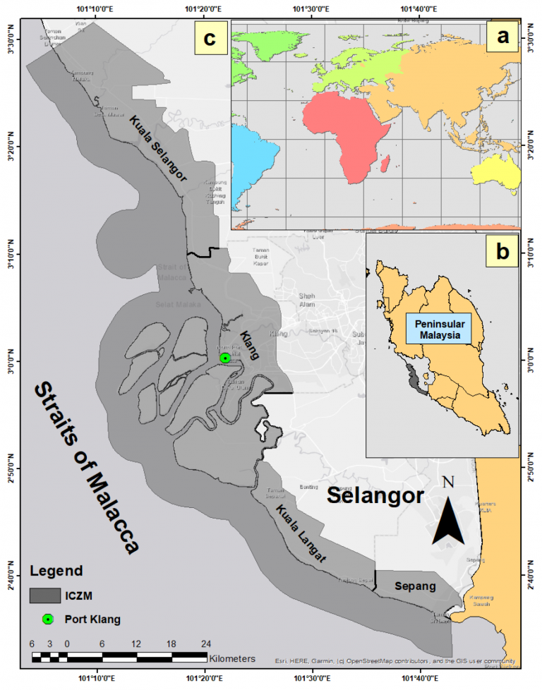
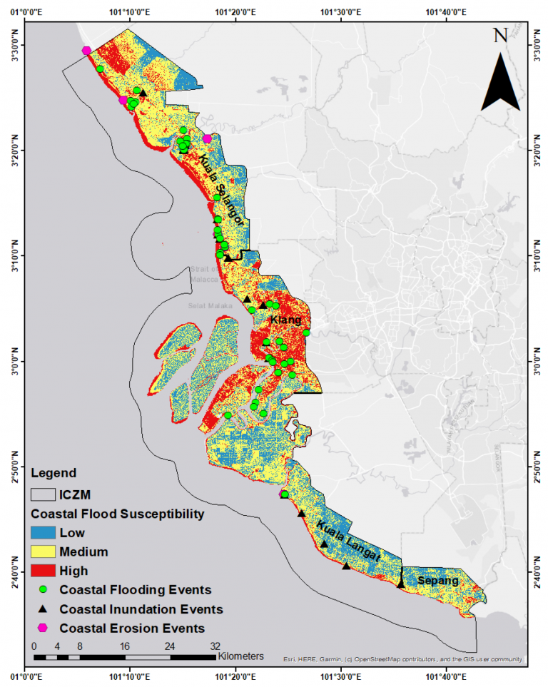
The land subsidence and coastal flood dataset for Selangor, Malaysia, was developed using Sentinel-1 radar satellite imagery obtained from the European Space Agency’s Copernicus Program covering the years 2015 to 2022. The data were processed using the Small Baseline Subset Interferometric Synthetic Aperture Radar (SBAS-InSAR) technique to detect and measure vertical ground movements across the coastal region. Results indicated that the average rate of land subsidence in Selangor was approximately 13 mm per year, with maximum downward displacement rates recorded at −46 mm/year (descending orbit) and −61 mm/year (ascending orbit). These values highlight areas experiencing significant ground sinking, particularly in low-lying coastal zones.
In addition, Digital Elevation Model (DEM) data and Integrated Coastal Zone Management (ICZM) boundaries were used to map flood-prone areas. When combined with sea-level rise projections from the IPCC Sixth Assessment Report (AR6), the dataset showed that the relative water level could rise up to 2.124 meters by 2100 under the worst-case scenario. Overall, the dataset reveals that about 82% of Selangor’s coastal management area is vulnerable to land subsidence or coastal flooding, posing serious risks to built-up and agricultural areas.
The dataset consists of Sentinel-1 satellite radar images collected from 2015 to 2022 to measure land subsidence along the Selangor coastline. The data were processed using the SBAS-InSAR technique to detect vertical ground displacement over time. It contains multiple attributes, including Location (Latitude, Longitude), Year, Subsidence Rate (mm/year), and Orbit Direction (Ascending/Descending). The dataset also integrates Digital Elevation Model (DEM) and IPCC AR6 sea-level projection values to estimate relative water-level changes. The header names represent each variable, while each row corresponds to a specific observation point or grid cell within the study area. The total dataset includes thousands of observation points covering approximately 1,856 km² of the Integrated Coastal Zone Management (ICZM) area, providing a detailed spatial representation of subsidence and flood vulnerability patterns across Selangor.
| TEMPORAL COVERAGE | : | 2015 – 2022 |
| TEMPORAL FREQUENCY | : | Yearly |
| SPATIAL COVERAGE | : | Coastal region of Selangor, Peninsular Malaysia |
| SPATIAL RESOLUTION | : | – |
| VARIABLES | : | Land Cover, Land Subsidence |
MyIKLIM database. Available online: https://myiklimysd.ukm.my/lcsh_001_seadpri/ [accessed on: enter date]
| CONTACT PERSON | : | Navakanesh M Batmanathan |
| FUNDING INFORMATION | : | This work was conducted with the aid of a grant from the International Development Research Centre (IDRC), Ottawa, Canada [Grant No: 109162-001], and Universiti Kebangsaan Malaysia [Project Code: XX-2019-011]. |
| REFERENCE | : | Batmanathan, N.M.; Pereira, J.J.; Shah, A.A.; Muhamad, N.; Sian, L.C. Land Subsidence and Coastal Flood Impact Scenarios Based on Remote Sensing in Selangor, Malaysia. J. Mar. Sci. Eng. 2025, 13, 1539. https://doi.org/10.3390/jmse13081539. |